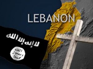
ISIS threatens to crucify Lebanon’s Christians as the Islamic State prepares to cross Syria border
 Christians in Lebanon’s Bekaa Valley have begun arming themselves in preparation for an ISIS (now known as the Islamic State) offensive as it seeks to expand its territorial control outside of Syria. For Christians, who comprise 20% of Lebanon’s population, it will be fight or flight.
IB Times Up to 3,000 militants from the Islamic State and other jihadists occupy the mountain range between Lebanon and Syria near the Sunni town of Arsal.
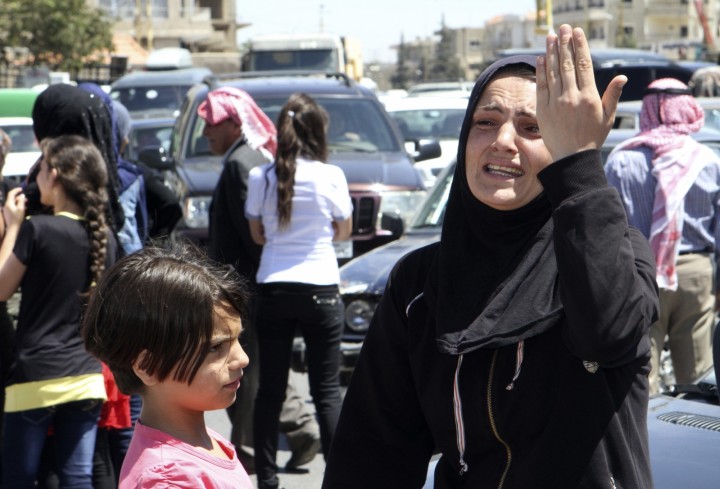
A woman reacts during a sit-in organized by families of the Lebanese soldiers who were captured by Islamist militants in Arsal, demanding their release in the Lebanese town of Baalbek in the Bekaa Valley
As ISIS seeks to grab land outside of the mountain caves and farms they currently control, Christian volunteers have now created village defence forces to protect against the Sunni militants who have taken up to 21 Lebanese soldiers and policemen hostage.
“We are a minority and we are under threat by the jihadists,” Rifaat Nasrallah, a commander of the volunteer guards in the Greek Catholic town of Ras Baalbek, said. “It wasn’t the idea of anyone in particular,” Nasrallah says of the formation of defence units. “The whole village felt in danger so we all agreed it was necessary.”
“We don’t shoot if we see someone or something moving in the mountains,” said one of the watchmen. “We just call the Army and they investigate.” Ras Baalbek has a population of 15,000 and is separated from the flashpoint town of Arsal by a range of hills.
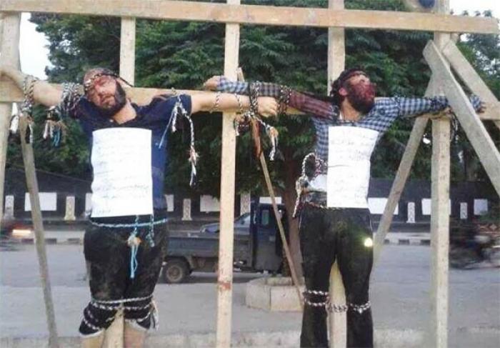
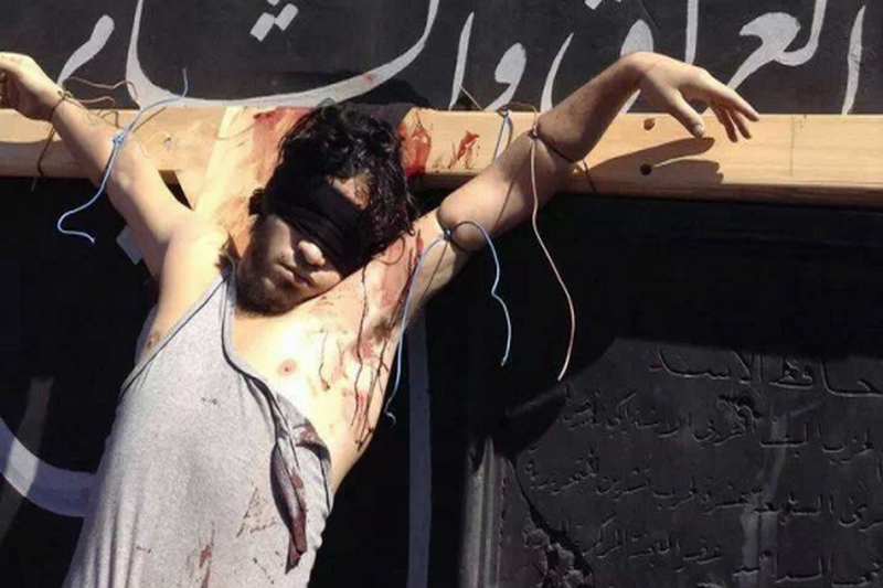
“Imagine if Islamic State makes it into Ras Baalbek and they crucify a Christian. It will set Lebanon alight,” a western diplomat in the Lebanese capital of Beirut, speaking on condition of anonymity, told The Times. There are approximately 2.4m Chrisitans in Lebanon, 20% of the total population.
The terror group has continued to crack down on religious freedom since the announcement of its Islamic “caliphate”, straddling the Iraqi-Syrian border. The Sunni jihadists have taken over Iraq’s largest Christian town of Qaraqosh causing thousands of residents to flee towards Kurdistan region.
They also issued an ultimatum to Christians in the city of Mosul to convert to their radical form of Islam or be forced to either pay a tax, leave the city or be harmed for refusal to convert.
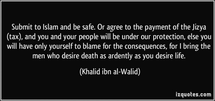
The city is now reportedly empty of Christians as hundreds of families fled following the ultimatum of death or a historic contract ‒ known as “dhimma”‒ where non-Muslims can receive protection if they pay a fee known as a “jizya.”
ISIS has now beheaded it’s second of the nineteen hostages taken during the brief occupation of the North Lebanon border town of Arsal.
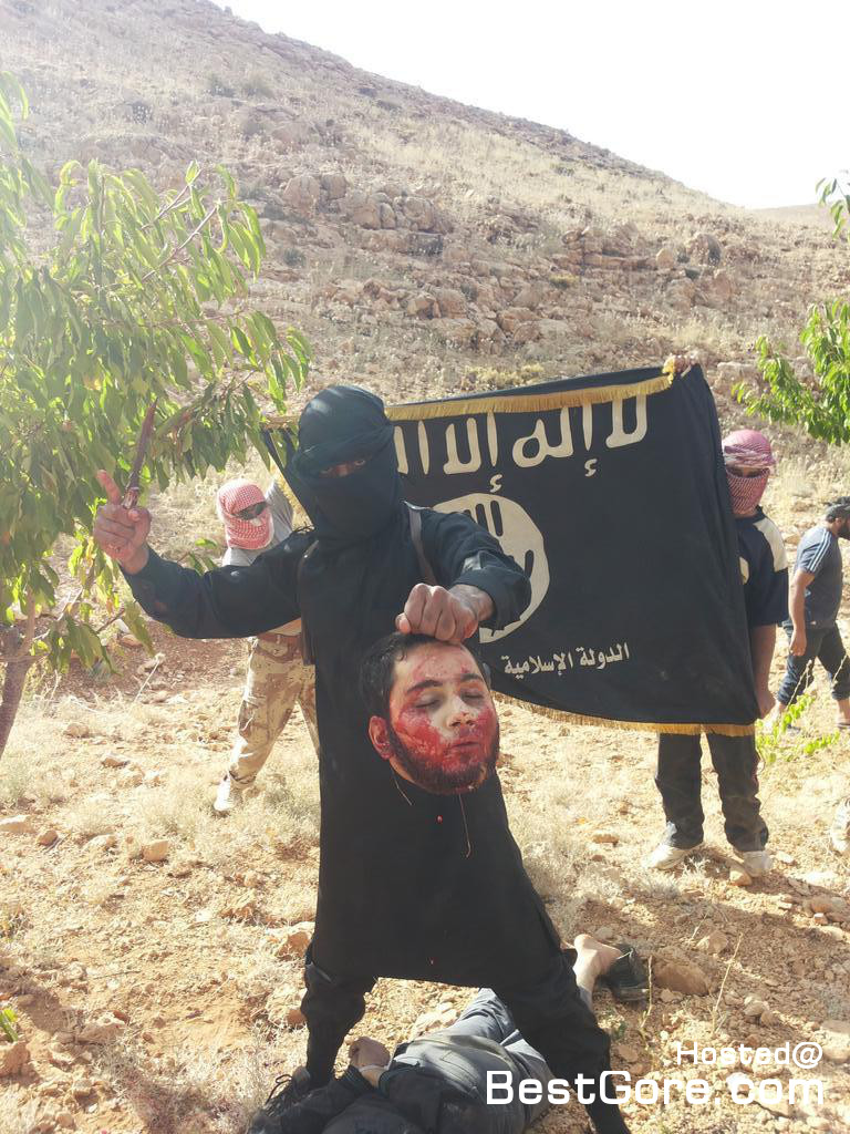
ISIS beheading of Lebanese soldier:
ΤΟ ΤΕΛΕΥΤΑΙΟ ΒΙΝΤΕΟ ΚΑΛΥΤΕΡΑ ΝΑ ΜΗΝ ΤΟ ΔΕΙΤΕ ΔΙΟΤΙ ΑΥΤΟ ΠΟΥ ΘΑ ΔΕΙΤΕ ΕΙΝΑΙ ΕΙΝΑΙ ΝΑ ΚΟΒΟΥΝΕ ΤΟ ΚΕΦΑΛΙ ΕΝΟΣ ΑΝΔΡΑ!! ΜΕ ΟΛΗ ΤΗΝ ΣΗΜΑΣΙΑ ΛΙΓΟ ΛΙΓΟ ΚΑΤΙ ΑΝΑΝΔΡΑ ΣΚΟΥΛΙΚΙΑ.
Ο ΘΕΟΣ ΕΙΝΑΙ ΜΕΓΑΛΟΣ ΚΑΙ ΑΓΑΠΑΗ ΚΑΙ ΤΟΝ ΚΛΕΦΤΗ ΚΑΙ ΤΟΝ ΝΟΙΚΟΚΥΡΗ.
ΕΧΟΥΜΕ ΓΝΩΡΙΣΗ ΧΡΟΝΙΑ ΤΩΡΑ ΤΕΤΟΙΕΣ ΒΙΑΙΟΤΗΤΕΣ ΕΔΩ ΣΤΗΝ ΕΛΛΑΔΑ ΜΕ ΤΟΥΣ ΒΑΡΒΑΡΟΥΣ ΚΑΙ ΣΠΑΡΑΖΗ Η ΚΑΡΔΙΑ ΜΑΣ ΜΟΛΙΣ ΒΛΕΠΟΥΜΕ ΤΕΤΟΙΑ ΠΡΑΓΜΑΤΑ. ΕΛΕΟΣ!


